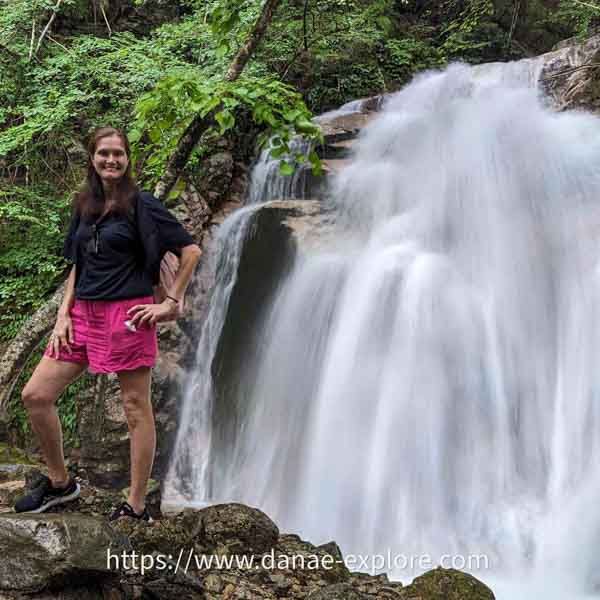
How about setting out along the legendary Samurai Route, along paths that samurai, feudal lords, and traders once traveled for centuries?
The Nakasendo Road is one of Japan’s most famous routes, running through the Kiso Valley in the Japanese Alps.
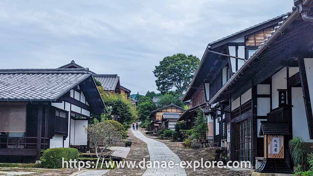
Imagine villages that feel frozen in time, with dark wooden houses and paper lanterns, connected by a path that winds through forests, mountains, streams, waterfalls, and rice fields. Walking the Nakasendo Road, it’s hard not to feel like you’ve stepped onto a samurai movie set.
First of all, follow me on Instagram @danae_explore – that’s where you can keep up with my trips, find lots of travel tips, and send me a DM anytime. I love chatting about travel!
In this post, I’ll share what makes the Nakasendo Route so special and how to walk it yourself — and I’ll say this upfront: the hike is easy, well signposted, and doesn’t require a high level of fitness.
It was one of the most special experiences we had during our month long trip to Japan and I’m sure it will be one of yours too!
This is just the beginning — Japan has so much more to offer. Here on the blog, alongside our full 4-week Japan itinerary, you’ll also find accommodation tips for Tokyo, detailed guides for Kyoto, Hiroshima and Sapporo, and even the Tateyama-Kurobe Alpine Route if you’re looking to get a bit off the beaten path. Let’s make this trip happen!
This is just the beginning, Japan has so much more to offer. Here on the blog, alongside our full 4-week itinerary from the first trip, you’ll find accommodation tips for Tokyo, detailed guides for Kyoto, Hiroshima and Sapporo, and even the Tateyama-Kurobe Alpine Route if you’re looking to get a bit off the beaten path. Japan is waiting for you!
What is the Nakasendo Road?
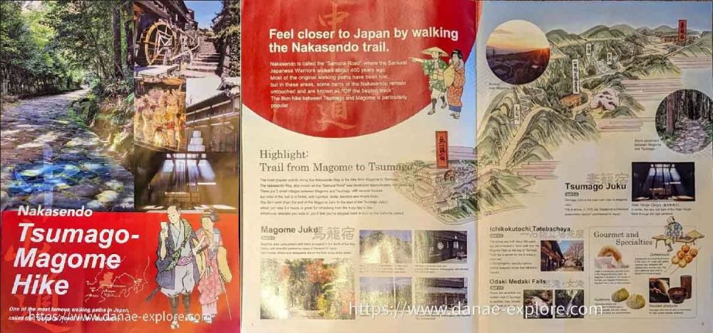
The Nakasendo Road means “central mountain road.” It was one of the five main routes connecting Edo (present-day Tokyo) to Kyoto, which was the capital at the time, during the Edo Period (1603–1868).
This roughly 500-kilometer route was used by samurai, traders, and messengers. Along the way, there was a series of “post towns,” small villages where travelers could rest and spend the night. There were around 200 post towns across the five routes during the Edo period. On the Nakasendo Road, there were 69, making it the route with the highest number of post towns.
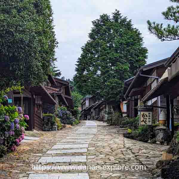
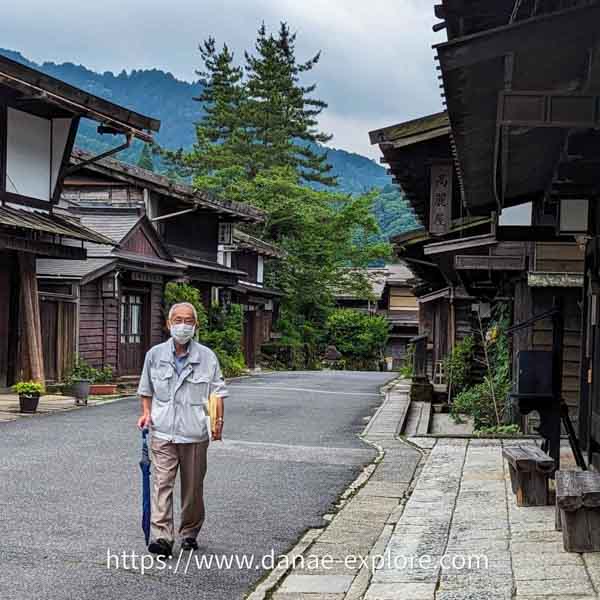
Magome (also known as Magome-juku) and Tsumago (or Tsumago-juku) are two of the best-preserved post towns, and the path between them is one of the few remaining sections of the original Nakasendo Road.
This is the section we walked during our 4-week trip to Japan.
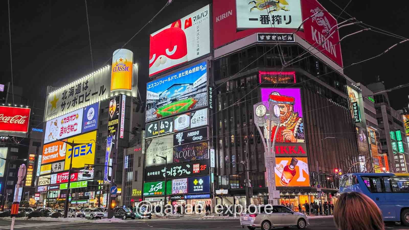
We loved Japan so much that we were back before long, this time in winter: skiing in Sapporo, revisiting old favorites (hello again, Tokyo, Hiroshima and Kyoto), and adding some new ones like Kanazawa and Himeji. Check it all out here on the blog or over on Instagram.
.
How I discovered the Nakasendo Road
You might be wondering how I came across this experience, so far from the usual tourist trail in Japan.
The team at the Japan National Tourism Organization (JNTO), the official tourism agency of the Japanese government, first told me about it. They are available every weekend at Japan House São Paulo, Brazil (where I live), to help you plan your trip to Japan. I can confidently say that without their tips and guidance, our trip wouldn’t have been nearly as smooth. Best of all, their service is free. Check whether there’s a branch near where you live.
That’s where I first heard about the Nakasendo Road and picked up some initial information. The rest, as always, came from what I found on blogs and the limited information I found on Lonely Planet. We decided to go for it, and added a pretty unique experience in Japan to our itinerary.
If you’re looking for another off-the-beaten-path experience in Japan, check out the Tateyama Kurobe Alpine Route, where we crossed the Japanese Alps.
.
How to get to Magome or Tsumago
We started the Nakasendo Road hike in Magome; if you’re starting in Tsumago, just follow these directions in reverse 😉
The most common way to get to Magome is to take a train to Nagoya Station. We traveled from Tokyo to Nagoya on the Shinkansen, Japan’s bullet train. Along the way, you may get a chance to see Mount Fuji — sit on the right side of the train for the best view of Japan’s most iconic mountain.
From Nagoya, we took a regional train to Nakatsugawa (JR Chuo Line Rapid Train). You can also reach Nakatsugawa from other towns in the region, such as Matsumoto or Nagano.
From Nakatsugawa, just take a local bus to Magome. The bus stop is right in front of the station, so you can’t miss it. Google Maps has everything mapped out and will show you the exact bus stop location and times. We relied entirely on the app, and it worked perfectly.
.
.
Where to stay in Magome
Both Magome and Tsumago have a few accommodation options, though choices are limited. You can also stay in nearby towns like Nakatsugawa, Nagiso, or even Matsumoto and visit the Nakasendo Route as a day trip.
But the more I researched the Nakasendo Route, the more I felt that staying at least one night in one of the post towns was worth it.
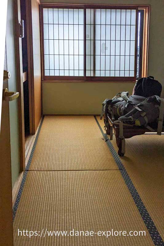
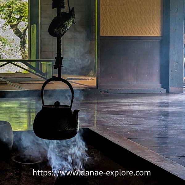
We decided to spend the night in Magome, and of course, I chose a ryokan.
Ryokans are traditional Japanese inns — exactly the kind of place you picture when you think of Japan: tatami mat floors, paper sliding doors, futon beds, sliding doors, kaiseki meals, and, to top it off, hot spring baths (onsen). Not to mention the kimonos (yukatas) and straw slippers.
Our ryokan, Magome Chaya, had all of this, except for the onsen. It was the most fascinating accommodation experience we had in Japan. It wasn’t luxurious at all (and I admit the pillow left something to be desired), and the bathroom was shared, but the whole experience made it unforgettable.
Since everything in the village closes at night, we chose to have dinner and breakfast at the ryokan. Both meals followed the traditional Japanese style, with a sequence of several small dishes (kaiseki), without a doubt one of the best meals we had during our 4-week trip to Japan.
Other highly recommended options in Magome include the Nedoko Guesthouse and Tajimaya Ryokan, both also traditional inns.
Check availability and prices here:
.

.
Luggage fowarding service on the Nakasendo Route
Before you ask: you don’t need to carry your bags during the hike (unless you want to, of course).
Between Magome and Tsumago, there is a luggage forwarding service.
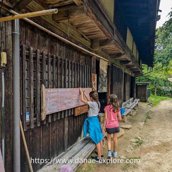
You drop off your bags and backpacks at the Magome tourist information center and pick them up at the tourist information center in Tsumago, or vice versa.
In Magome, the luggage drop-off point is right next to the Magome Chaya ryokan and in front of the Toson Memorial Museum; in Tsumago, it’s in the center of the village, next to the post office.
It costs ¥1000 per item. Just leave your bags at one of the information centers between 8:30 am and 11:30 am and pick them up at the other between 1:00 pm and 5:00 pm.
Check the official Magome or Tsumago website for the service’s operating season, which usually runs from April to November, as well as the exact drop-off and pickup times when you plan to use it.
.
.
When to do the Magome-Tsumago trail
The best time to hike the Nakasendo Route between Magome and Tsumago is from April to November, when there is little to no snow. We did it in July and it was perfect.
(But if I could, I would choose autumn — the colors must be stunning!)
.
.
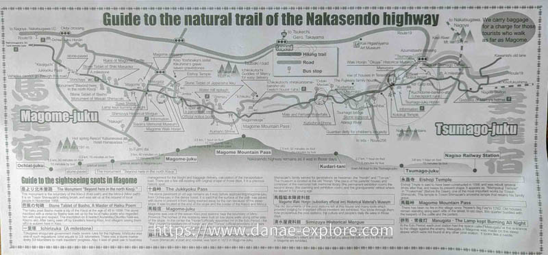
Nakasendo Road (Magome to Tsumago): what to expect
The Nakasendo Road between Magome and Tsumago is about 8 kilometers long and takes around 2 to 3 hours to complete.
We took our time, stopping to rest, enjoy the views, and have snacks, so it took us just over three hours.
There’s no fee to hike it — it’s free, open to all, and suitable for most people.
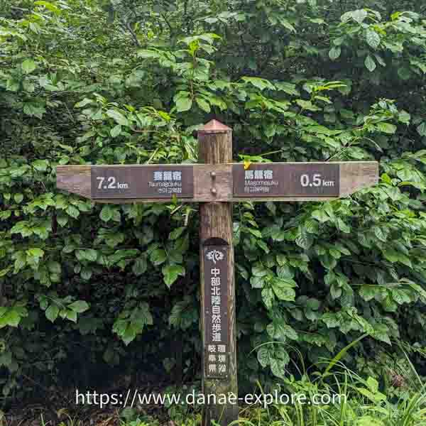
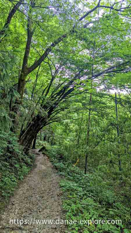
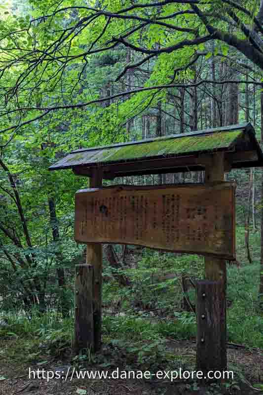
The path is very well marked throughout, so it’s hard to get lost along the way.
Magome sits at around 600 meters above sea level, while Tsumago is at 420 meters. The highest point on the route, Magome Pass, reaches 801 meters. Starting from Magome, you’ll gain about 200 meters in elevation; from Tsumago, it’s around 380 meters. This is why most people (us included!) choose to hike from Magome to Tsumago.
.
.
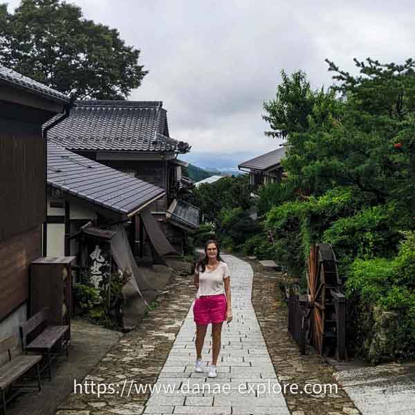
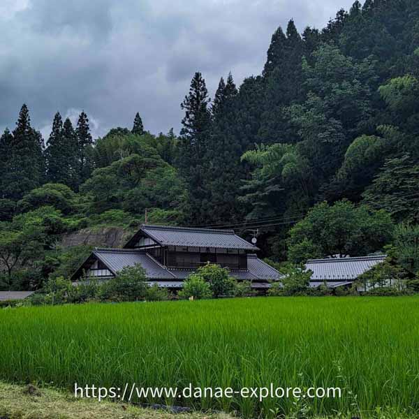
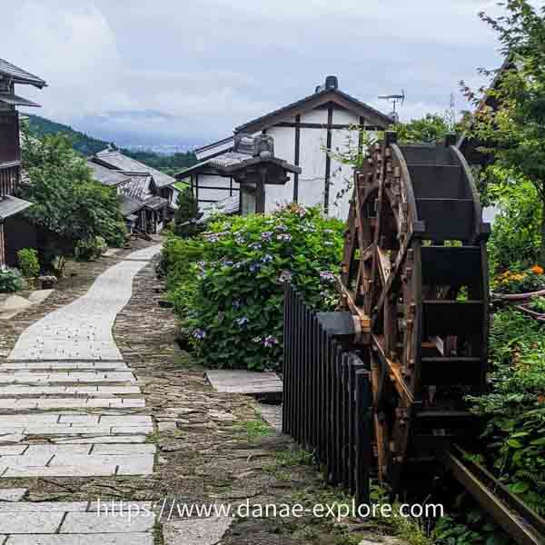
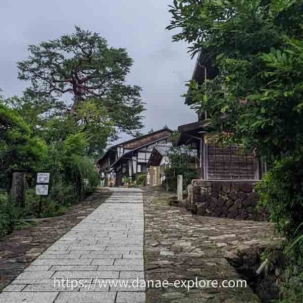
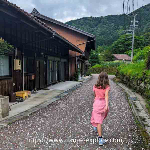
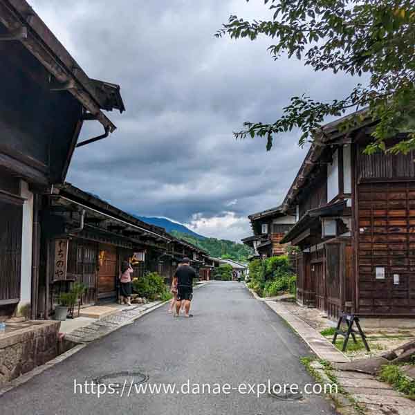
Magome-juku
At the entrance to Magome-juku, there’s a watermill, one of the town’s symbols, and a sharp curve to the right. These curves were a strategic feature, designed to slow down enemy troops and give residents more time to defend the town.
Another interesting aspect of the village is that Magome is one of the few post towns built on a hill. The watermills played an important role, not only in providing power but also in fire prevention — the town was destroyed by fire twice, in 1895 and 1915.
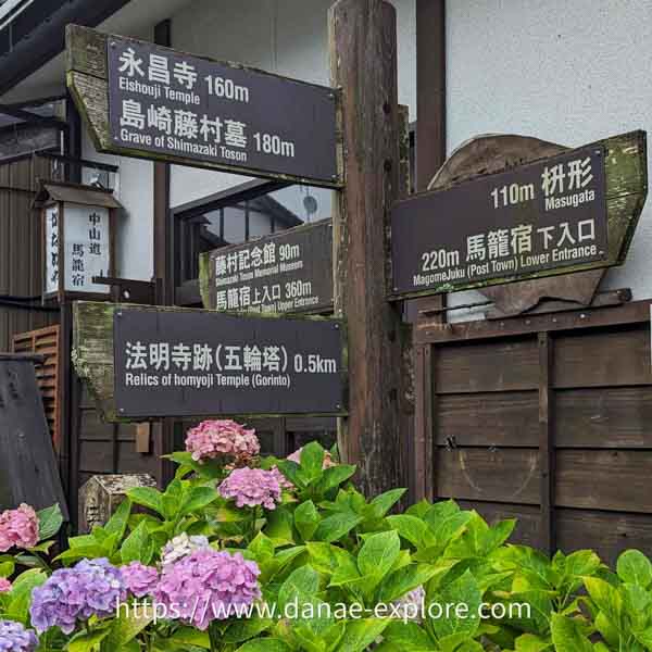
Near the Magome Chaya ryokan is the Toson Memorial Museum, dedicated to the renowned Japanese writer Shimazaki Toson, who was born and spent much of his childhood here.
.
.
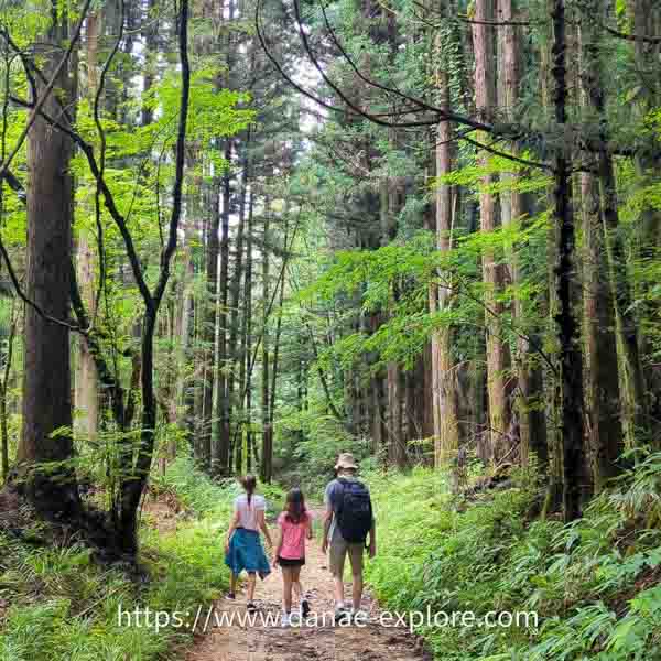
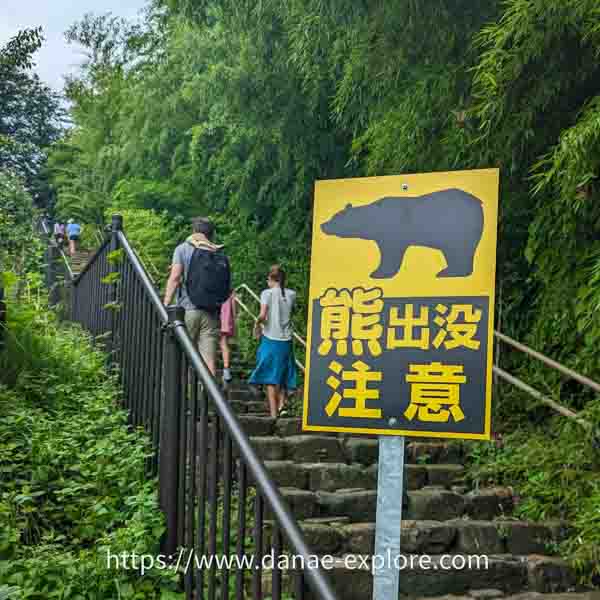
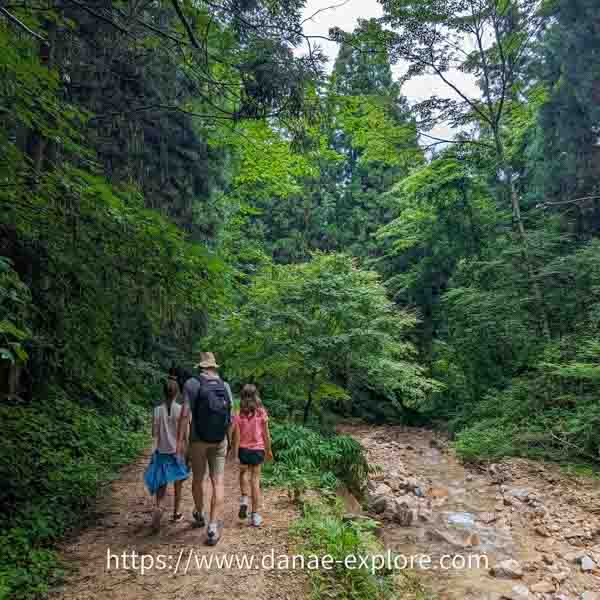
The trail
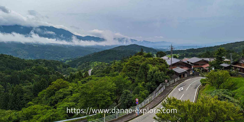
Leaving Magome, the route continues through forests and rural landscapes, with a long uphill stretch — mostly gradual, but with some steeper sections and a few areas with steps.
The uphill section is 2.4 km long, with an elevation gain of around 200 meters. The highest point is Magome Pass. From there, it’s all downhill to Tsumago.
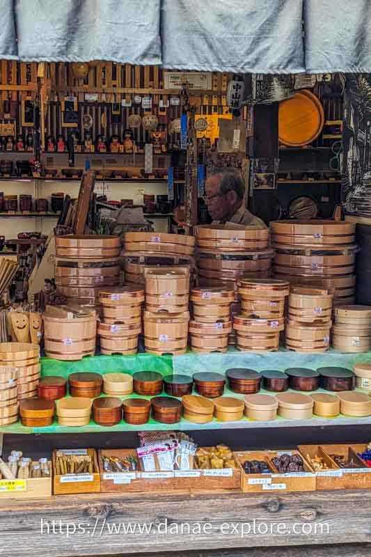
About 850 meters past the highest point, you’ll reach Ichikokutochi Tatebachaya, a tea house with over 300 years of history — probably one of the most authentic you’ll come across in Japan. It’s a perfect place for a well-deserved break, where you can enjoy complimentary tea. Unlike most places in Japan, tips are welcome here.
.
.
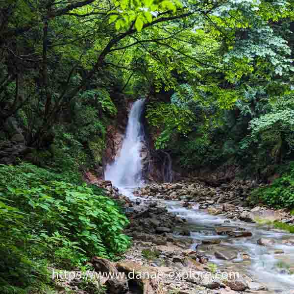
From there, you enter what I think is the most beautiful section of the route. The path follows a small stream through a forest of cypress, cedar, bamboo, and maple trees. After about 1.8 km, you’ll reach the two waterfalls along the route: Odaki and Medaki.
.
.
After the waterfalls, it’s another 3.8 km to Tsumago.
When we did the hike, part of this final section was blocked by a landslide that had occurred a few days earlier. We followed a paved road for about 2 km to Omata Bridge, where we rejoined the historic path for the final stretch of the Nakasendo Road, just as we were approaching Tsumago.
.
.
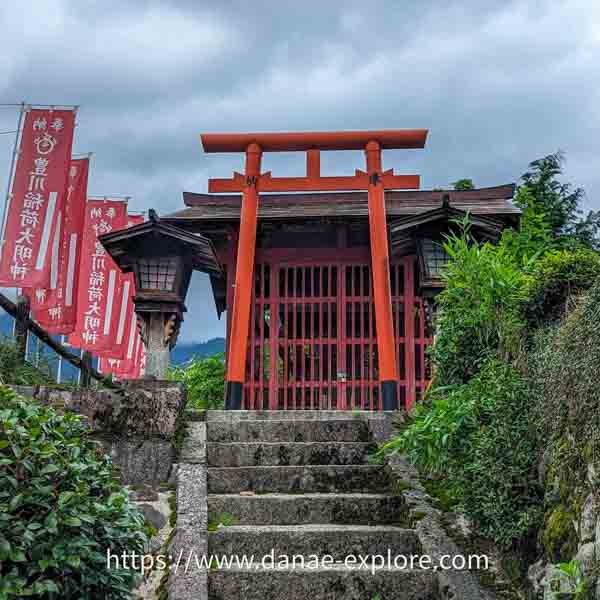
Tsumago
When we arrived in Tsumago, I was struck by how different it felt from Magome, yet so similar at the same time! (Does that make sense? Probably not 😅)
In Tsumago, it’s worth visiting the Nagisomachi Museum, which is made up of three parts: Waki Honjin Okuya (dating from 1877), Tsumago-juku Honjin, and the historical archive.
The Tsumago-juku Honjin is a full-scale reconstruction of the lodging used by daimyos, the feudal lords, when they traveled along the Nakasendo Road.
.
.
We had lunch at Omote, right next to the Tsumago tourist information center, where we picked up our bags. After exploring the village a bit more, we walked down to the bus stop for Nagiso.
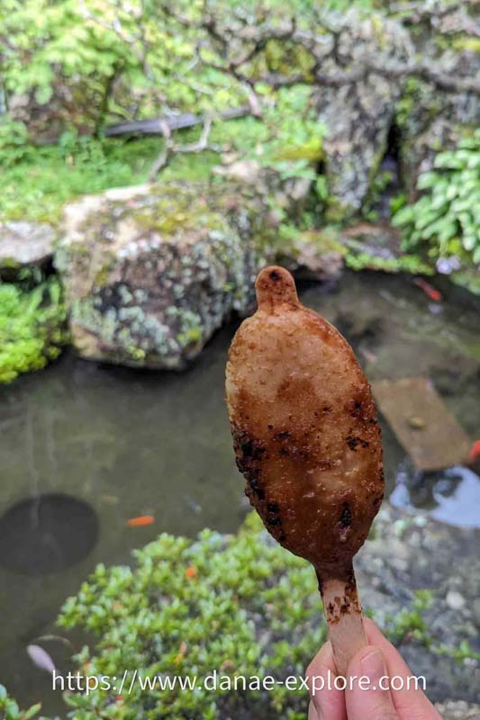
Oh, and don’t forget to try goheimochi, the regional treat — a grilled rice skewer with a sweet sauce. It’s delicious!
In Nagiso, we took the train to Matsumoto; in the post with our 4-week Japan itinerary you can see the rest of the trip.
.
.
Tips for the walk
– Wear comfortable clothing and suitable footwear — regular sneakers are enough; no need for specialized trekking gear.
– Bring water and some snacks. While there are a few spots along the way where you can buy water, ice cream, and snacks, don’t miss a stop at Ichikokutochi Tatebachaya for a cup of tea.
– Follow the marked path and respect the environment: Leave nothing but footprints, kill nothing but time, take nothing but pictures (and, of course, your trash!).
– If you’re not staying in Tsumago (or in Magome, if you’re doing the route in the opposite direction), be sure to check return bus times. In addition to Google Maps, it’s worth stopping by the tourist information center to confirm departure schedules.
.
In summary, the days we spent in Magome and Tsumago, along with the hike on the Nakasendo Road, were highlights of our trip. It was here that we truly felt immersed in traditional Japan and its natural beauty. The serenity of the landscape and the charm of the villages made this journey a unique experience.
.
.
If you want to learn more about the two post-towns, check out the official tourism association link for Magome-juku and Tsumago-juku.
.
Here are the websites I always use to plan my trips:
– 🛌 Accommodation: Booking
– ☀️ Tours & activities: Civitatis & Get Your Guide
– 📱 eSIM for mobile data: Airalo e-SIM – use promo code DANAE2375
– 🚗 Car rental: RentCars – use promo code DANAE
Check out all our posts about traveling in JAPAN:
- 4-week Japan itinerary: the best of Japan for a first trip to the Land of the rising sun
- Where to stay in Tokyo
- The best of Kyoto: what to do in 4 or 5 days in Japan’s ancient capital
- Tateyama Kurobe Alpine Route – Your ultimate guide to the journey crossing the Japanese Alps
- Nakasendo Road, from Magome to Tsumago, the most beautiful villages of medieval Japan
- Hiroshima: 2-day itinerary, with a day trip to Miyajima
- Sapporo: complete itinerary and tips for skiing in Hokkaido
- 10 things you need to know before traveling to Japan
.
Here are our posts about other destinations in Asia:
- 3-week itinerary through Southeast Asia – the best of Thailand, Laos and Cambodia
- Siem Reap and Angkor Wat in Cambodia
- New Year’s Eve in Siem Reap, Cambodia
- What to do in 3 days in Luang Prabang
- The best of South Korea: 7-10 day itinerary
.
Did you like these tips? Then follow me on social media:
Instagram @danae_explore
Pinterest @danaeexplore
Comments or questions? Contact me on social media! I love to chat about travel 😉
And before you go, don’t forget to SAVE THIS PIN to your PINTEREST account, to make it easy to find all these tips about how to hike the Nakasendo Road, between Magome and Tsumago, whenever you need it!