With its massive rock formations, viewpoints, and waterfalls, Chapada dos Guimarães National Park is one of the top attractions in the Brazilian Cerrado. Here, you’ll find trails for all fitness levels, rivers and pools perfect for floating, breathtaking waterfalls—many of which are ideal for swimming—and remarkable caves, all within a protected area of the Cerrado’s unique ecosystem.
In this post, I’ll share everything there is to do in Chapada dos Guimarães, an ideal spot to immerse yourself in the natural beauty of the Cerrado, complete with charming inns and easy access from Cuiabá.
And here are some other suggestions: a Chapada dos Veadeiros, where the best waterfalls in the world are located (my opinion lol), and the Chapada das Mesas, which combines waterfalls, trails and stunning landscapes, and is well worth a visit!
First of all, follow me on Instagram @danae_explore – that’s where you can keep up with my trips, find lots of travel tips, and send me a DM anytime. I love chatting about travel!
.
Fast facts
How to get there: it is 65 km from Cuiabá
Best time to visit: dry season from May to September
Ideal duration: 3 5 the day
Profile: for those who enjoy nature, trails, waterfalls and beautiful landscapes
Where to stay? Pousada do Parque or Pousada Vila Margarida; budget options include Pousada Canto dos Pássaros and Pousada Manga Rosa.
With children? Yes, kids will love!
Best tours: Cidade de Pedra (Stone Town), Circuito das Cavernas e Lagoa Azul (caves and blue lagoon), Morro Crista do Galo and Floating, Circuito das Cachoeiras (waterfalls) and Morro de São Jerônimo – click on the links for details of each tour
Need to rent a car? No, but if you rent, the best option is a 4×4 (link to rent with discount + promo code DANAE foir 5% off)
.
If you’re planning a trip to Brazil, you might also want to add Chapada das Mesas and Chapada dos Veadeiros to your itinerary, two national parks known for scenic hikes, viewpoints, waterfalls, and the unique landscapes of the cerrado. Here on the blog, you’ll also find tips for many other destinations in Brazil.
How to get to Chapada dos Guimarães
The town of Chapada dos Guimarães is about 65 km from Cuiabá and 80km from Cuiabá Airport (which, just out of curiosity, is in the municipality of Várzea Grande), which we covered in just over an hour by car.
We departed from São Paulo (Congonhas Airport) on a direct flight late on a Friday afternoon — just over two hours of flight time. There are flights connecting Cuiabá to major cities across Brazil, and with some advance planning, you can find great deals on airfare (like we did!).
.
.
When to visit Chapada dos Guimaraes
Chapada dos Guimarães is a year-round destination.
The climate is hot and rainy all year round., but in the summer it can be really hot, as well as being the rainiest season – February is the champion in precipitation. One positive point is that the rivers and waterfalls are fuller and bathing in the water is more inviting.
Winter brings drier weather. July and August are typically the driest months with clearer skies, though you may encounter some fog. Temperatures are also cooler, sometimes dropping to around twelve °C
We went in November, taking advantage of a 3-day long weekend.We had good, but overcast, weather and quite hot weather. Every day there was a heavy downpour in the late afternoon—a really heavy downpour, complete with lightning and thunderstorms, which ended in less than half an hour. Nothing that disrupted our trip; on the contrary, it was a great way to cool off after a long day of outdoor activities and make the evening temperatures more pleasant.
.
.
Where to stay in Chapada dos Guimarães
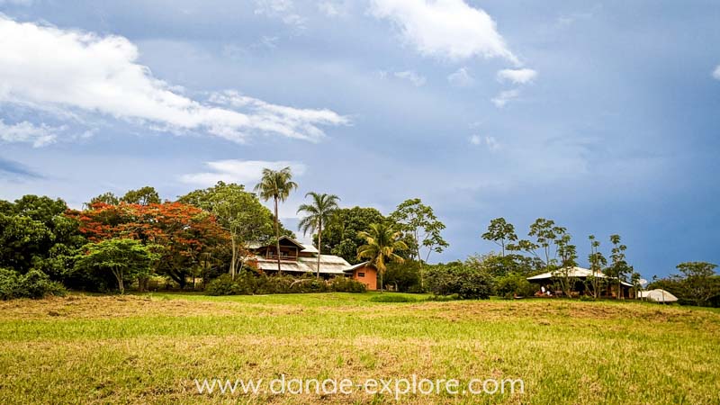
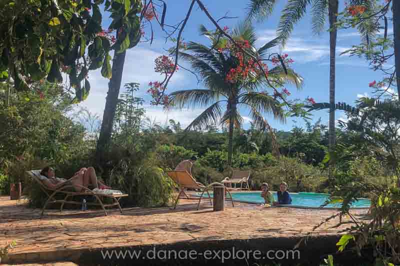
We stayed at Pousada do Parque which, besides being charming and delightful, is located on the edge of the Chapada, within the boundaries of the National Park. The girls loved the pool and the garden with swings. The restaurant is delicious and perfect for relaxing and enjoying a good meal, with an incredible view. The inn’s grounds include two seasonal waterfalls (which were dry when we visited), an observation tower, and some trails. Another beautiful option, nestled in the cerrado, is Pousada Atmã.
In the city, the ideal is to stay close to the block of the main church, the Sanctuary of Sant’Ana, so you’ll be close to bars, restaurants, shops, and travel agencies. Hotel Turismo is one of the most traditional in the city, but there are other options such as Pousada Vila Margarida. There is also no shortage of economical options, such as Pousada Canto dos Pássaros and Pousada Manga Rosa.
Check availability and rates here:
How to get around Chapada dos Guimaraes
We decided not to rent a car. Instead, we arranged transportation to and from the airport with the inn and did all our activities with the same guide, who drove us in his 4×4. While having your own car would lower the cost of tours, we found it more convenient to rely on the guide. The only downside was that we would have needed to arrange transportation if we wanted to go into town at night. We had planned to do that one evening, but after a full day of exploring, we were so tired—and the inn was so comfortable—that we ended up staying in.
If you are renting a car (at this link with a discount + cupom DANAE), or go with your own car, pay attention because most attractions are accessed via dirt roads, and some are only reachable by 4×4 vehicles (such as Crista do Galo and Poço da Anta). With a regular car, you’ll need to park and continue on foot for part of the way.
It’s important to note that public transportation to the attractions is very limited.
There are several local tourism agencies that organize tours. This link has several tours through Chapada, I highly recommend it as it makes logistics in the region much easier.
To rent a car, I always use RentCars, where I usually find the best options, and with the DANAE promo code you still get an additional 5% off. Shall we go?
.
How long to stay in Chapada dos Guimarães
We spent 3 full days in Chapada dos Guimarães, was enough to see the main attractions of the Park:
Day 1️⃣: Upper part of the Park
Day 2️⃣: Lower part of the Park
Day 3️⃣: Cave Circuit
In 5 days you can visit all the most popular attractions in the Park: one day for hiking the Morro de São Jerônimo and another for the Circuito das Cachoeiras (Waterfalls Circuit) and a few more waterfalls and viewpoints.
.
Have you seen our posts about Chapada dos Veadeiros and Chapada das Mesas? If not, go check them out, there are so many amazing places in Brazil to explore and fall in love with!
What to do in Chapada dos Guimaraes – Central Brazil
The main reason to visit is, of course, to explore Chapada dos Guimaraes National Park.
Encompassing 33 thousand hectares, it was created in 1989 and covers an area of cerrado, the second largest biome in the country. The park is open every day of the year and entry is free, although a guide is required to visit some of its attractions. More information about how to visit the park can be found on the official ICMBIO website, link here.
Beyond the park itself, there are plenty of nearby attractions, mostly waterfalls and scenic viewpoints.
.
.
1st day – Stone Town and Bridal Veil Waterfall
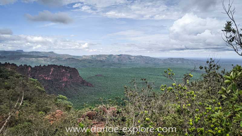
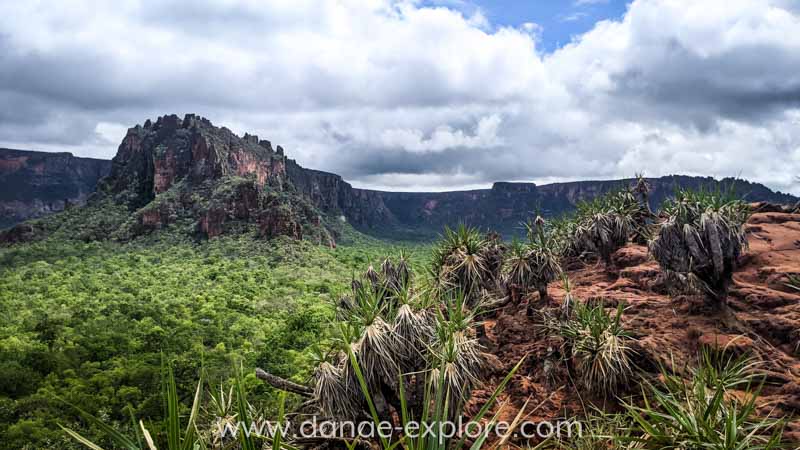
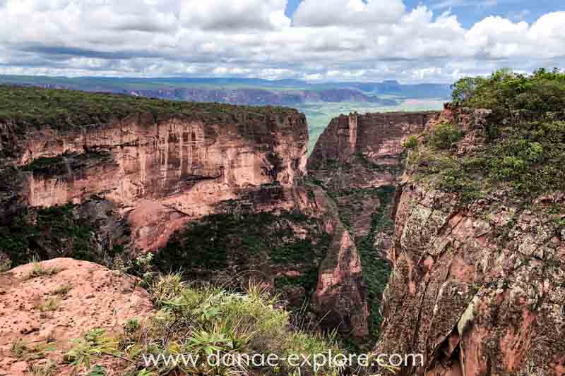
A Cidade de Pedra (Stone Town) is one of the most stunning spots in Chapada. Wind and rain have sculpted the rock formations into impressive cliffs that drop up to 350 meters, resembling the ruins of an ancient city —hence its name.
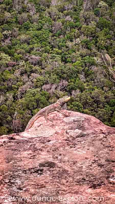
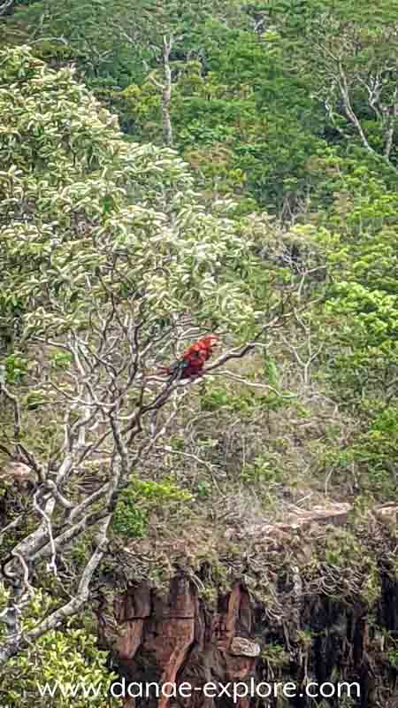
In the valley below, you can spot the sources of some of the park’s rivers, such as the Rio Mutuca and Rio Claro . We were lucky enough to see a few pairs of scarlet macaws , along with many other birds and reptiles.
The site is accessed via a 20 km dirt road, best suited for 4WD vehicles, and a guide is required. From the parking area, it’s about a one km round-trip hike to the viewpoint.
Here the link to book this tour.
.
.
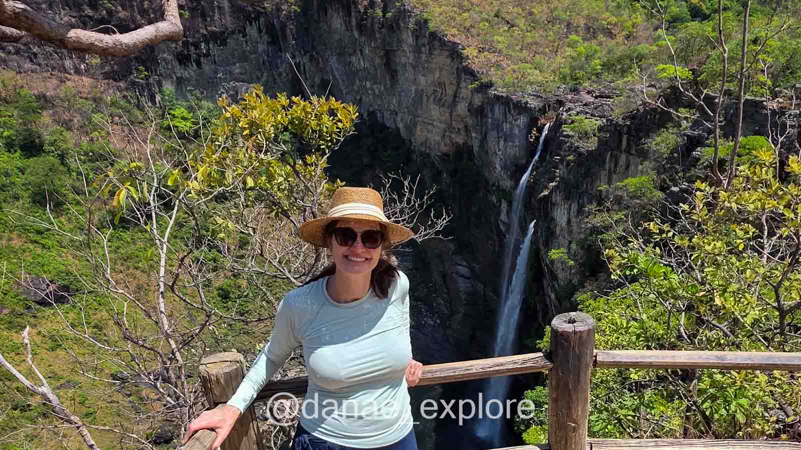
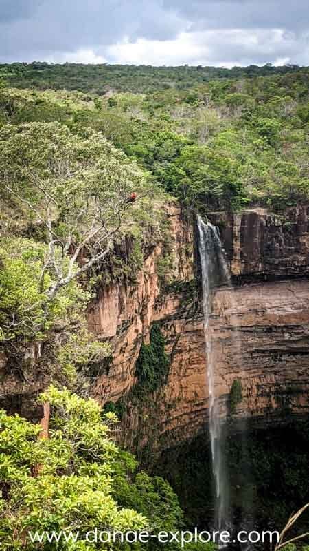
One of Mato Grosso’s most iconic landmarks, , Cachoeira Véu de Noiva (Bridal Veil Waterfall) It’s the park’s most visited attraction. Formed by the Coxipó River, the waters cascade approximately 86 meters down a sandstone wall, forming a huge pool. When we were there, the waterfall wasn’t very crowded, but it was still stunningly beautiful.
The viewpoint is easily accessible, just a short paved path from the parking lot. Unfortunately, after an accident a few years ago, it’s no longer allowed to descend to the pool or swim there.
We had lunch at the nearby restaurant, which serves well-prepared local food.
.

.
Waterfall Circuit of the Chapada dos Guimarães National Park
Starting from the Bridal Veil Waterfall, you can explore the park’s Waterfall Circuit, formed by the waters of the Independência stream, which descends to form six waterfalls: 7th of September, Pulo, Steps, Prainha, Swallows and Independence. Between the Prainha and Andorinhas waterfalls there are two natural pools. The route is around 6 km (round trip) and swimming is allowed in all waterfalls, except Independência.
Unfortunately, when we arrived, it was too late to start the trai — entry is allowed only between 9 a.m. and 12 p.m. (remembering that it is always good to check this information before going, either with a local guide or travel company, whether in the official ICMBIO website)
Here you can find the link to book this tour, if you do, tell me at Instagram if you enjoyed!
.

.
2nd day – Morro da Crista do Galo and floating on the Rio Claro
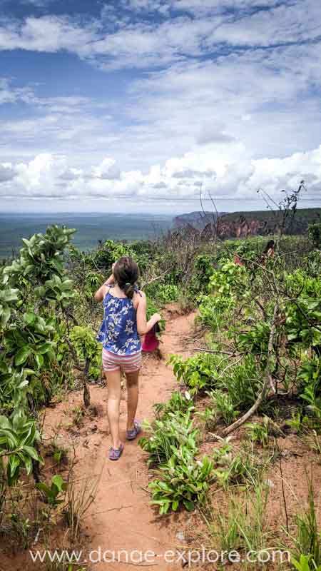
This tour is in the lower part of the Park, in the Rio Claro valley – the region we see from Cidade de Pedra (Stone Town).
You’ll need a guide for this tour, and a 4WD vehicle is recommended. If you don’t have one, you’ll need to walk the last 4 km of the road, which includes some sandy sections. Once you reach the trailhead, the hike is fairly easy, about 5 km long.
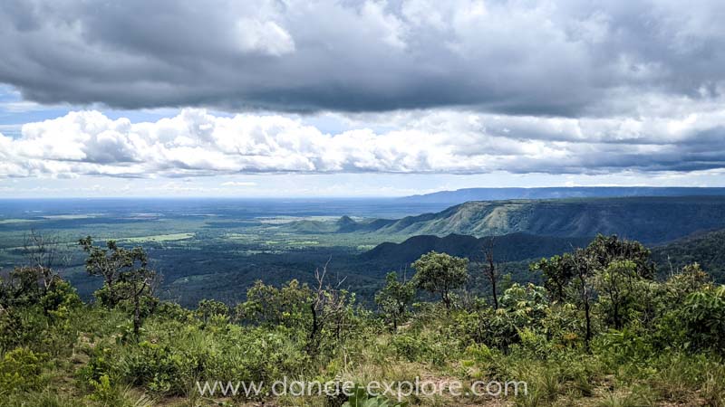
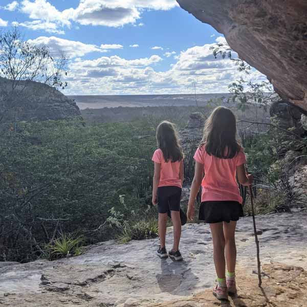
The first stop is at Crista de Galo (which translates as Rooster’s crest – seeing the photos you will understand why the place is named), a rock formation offering a stunning panoramic view of Chapada and the valley.
.
.
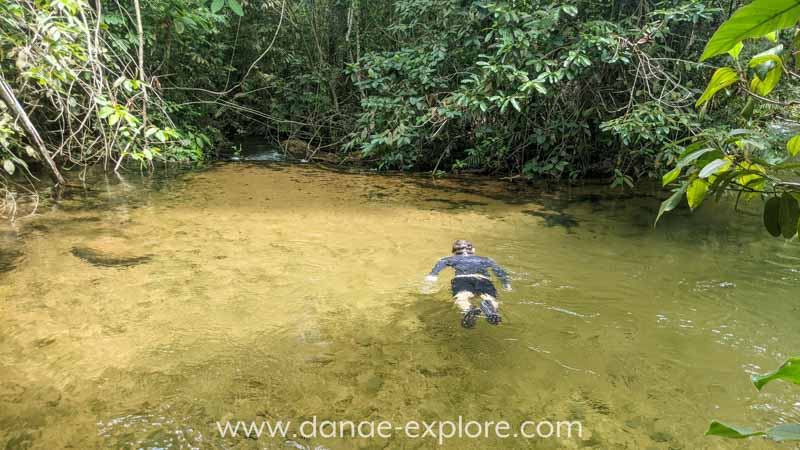
Next, we visited Poço da Anta, which is perfect for swimming and floating alongside different species of fish. We continued to the Poço Verde, where we got back in the water, but this time for a 30-minute float downstream, through a beautiful stretch of dense forest.
We had lunch at Cachoeira da Salgadeira Tourist Complex, located along the road that connects Cuiabá to Chapada. It’s set by a stream with several spots for swimming and offers a restaurant, outdoor play areas for kids, walking trails, and a small museum featuring a replica of a dinosaur that once lived in the region. While it’s not a must-see, it’s a nice place to stop for lunch if you’re passing by.
This tour includes the activities we did in these two days: Cidade de Pedra, Mirante da Crista do Galo and snorkeling at Poço da Anta.
.
.
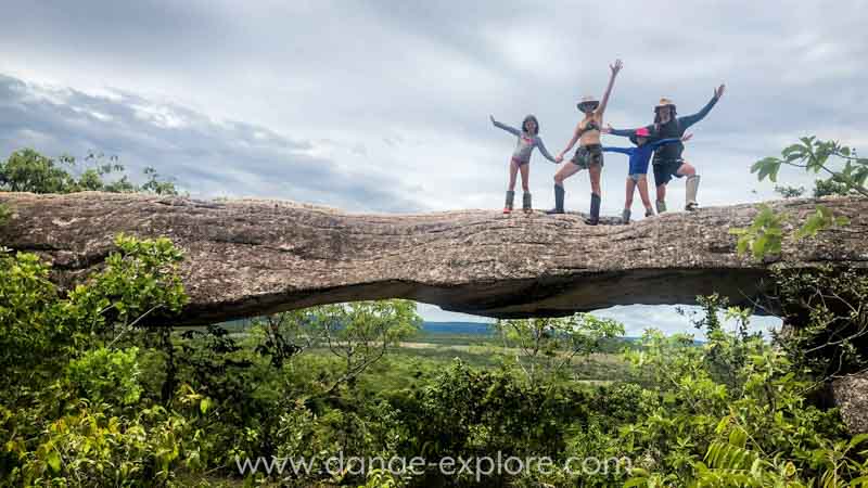
3rd day – Caves Circuit and Stone Bridge
On the last day, we made the call Cave Circuit, which is on private property and has a restaurant (where we had lunch). It is necessary to visit with a local guide and use of safety leggings (protection for the area between the knee and foot).
There is the option of doing the complete trail, approximately 12km round trip, or using the transport provided by the site, in adapted trucks, which cover a good part of the route, reducing the trail distance to approximately 2,5km.
Here is the link to this tour.
.
.
The tour starts at the Stone Bridge, with a fantastic view of the walls and the cerrado forest. From there, you can continue along the trail towards the caves, or return to reception and take transport further – that was our option.
The kids absolutely loved the ride in the truck. It added a unique and adventurous touch to the day. There are two stops along the way: most visitors get off at the first stop to begin their tour at the Aroe Jari Cave and finish at Pobe Jari Cave (where the truck makes its second stop). However, our guide suggested we do the route in reverse, starting at Pobe Jari and finishing at Aroe Jari.
.


.
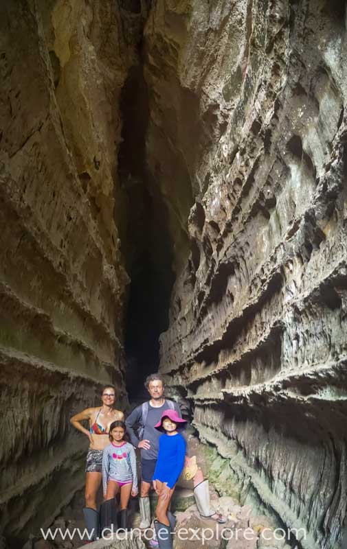
Pobe Jari Cave, which means “Cave of Two Mouths” in the indigenous language, is about 500 meters long and has two entrances, as the name suggests.
.
.
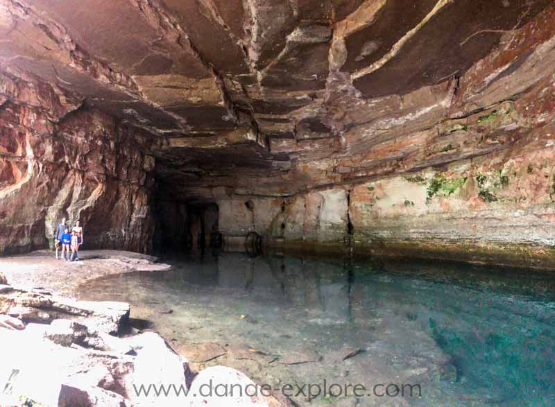
Next, we reached the Lagoa Azul, a stunning cave with a turquoise lagoon formed by water that springs from the rock. Swimming isn’t allowed, but the sight is spectacular.
We followed the trail through the cerrado forest and arrived at Kiogo Brado Cave, indigenous name that means “birds’ nest”.
In my opinion, this was the most impressive of the three caves. We entered from one side and walked its full 270-meter length, with 20-meter-high walls towering over us, before exiting the other end.
.

.
The last cave we visited was Aroe Jarior “Morada das Almas” (Dwelling of Souls) in the indigenous language. Spanning over 1.550 meters, with multiple forks and exits, it’s the largest sandstone cave in Brazil. Its main chambers are Chuveiro, where a waterfall cascades down, and Teto Dourado, where droplets of water on the ceiling reflect light from the lanterns, creating a golden glow.
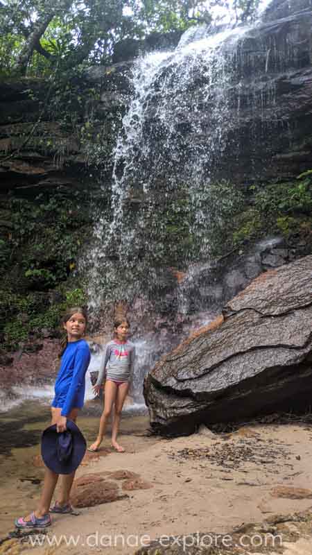
In the same area, we also stopped at Cachoeira do Relógio Waterfall, where we took a refreshing swim to wrap up the tour.
We did all of our tours with guide Iziel (+55 65 9 9966-3050). If he’s unavailable, it’s worth checking with other local agencies for tours like these, which even has an installment option.

.
Other Attractions
Here are some other recommended tours in the region that we didn’t have time to explore:
– Alto do Céu Viewpoint:
The only viewpoint offering a complete view of Cuiabá and other nearby cities. It has some trails and is popular in the afternoon for watching the sunset as the city of Cuiabá begins to light up.
– Morro dos Ventos:
With easy access, this site features a restaurant and two viewpoints, including a deck that overlooks Chapada from a height of two hundred meters.
– Morro de São Jerônimo:
The park’s highest point, it offers fantastic views of the region, provided you tackle the beautiful (and challenging, with several steep uphill sections) 20km round-trip trail. Guided tours are required.
– Other waterfalls:
Additionally, there are several waterfalls located in private areas around the park, many of which feature changing rooms, bars, restaurants, and playgrounds for children. Some of these include:
- Marimbondo Waterfall and Geladeira Waterfall
- Circuito das Águas do Cerrado
- Jamacá Waterfall
- Pingador Waterfall
- Mata Fria Waterfall
- Balneário do Rio Paciência
- Balneário do Rio Claro
- Balneário do Rio Mutuca
- Estância Fênix
.

.
Trivia facts
What are Chapadas?
A chapada is a type of landform with an elevated area of considerable size, featuring a relatively flat top and bordered by steep cliffs. The lower regions of chapadas are typically flat with low-growing vegetation. These areas are home to a rich diversity of flora and fauna and are often protected for environmental conservation.
How many Chapadas are there in Brazil?
There are seven Chapadas, in six Brazilian states:
1️⃣ Chapada dos Guimarães, Brazil
2️⃣ Chapada das Mesas, in Maranhão – check out our post with all you need to know to visit this unknow Brazilian nature paradise, one of the most beautiful and least visited Chapadas in our country.
3️⃣ Chapada dos Veadeiros, in Goiás – here on the blog you will find all the information you need to visit my favorite Chapada and its amazing waterfalls.
4️⃣ Chapada Diamantina, in Bahia
5️⃣ Chpada do Araripe, in Ceara
6️⃣ Chapada dos Parecis, in Mato Grosso
7️⃣ Chapada do Guarani, in São Paulo State, near the towns of Analândia and Brotas.
.
.
Detailed itinerary
Here the map from Google MyMaps, with our detailed itinerary, Just click and save to your Google account. When you plan your next trip to Chapada dos Guimarães, you already know where to start 😉
On the map, you can see all the details of our journey, including where we stayed and the places we visited. There are different layers in various colors, one for each day of activities, plus a final layer for the spots we didn’t have time to visit.
How to use this map: Click the menu tab in the upper left corner of the map to access different layers, including points of interest and routes. You can toggle layers on and off by checking the corresponding boxes. To see details about specific locations, click on the icons on the map.
To save this map to your Google Maps account, just click the star icon next to the map title. To access it later on your phone or computer, open Google Maps, tap the menu button, go to “Your Places”, select “Maps”, and you’ll find this map saved there.
Here are the websites I always use to plan my trips:
– 🛌 Accommodation: Booking
– ☀️ Tours & activities: Civitatis & Get Your Guide
– 📱 eSIM for mobile data: Airalo e-SIM – use promo code DANAE2375
– 🚗 Car rental: RentCars – use promo code DANAE
.
All our posts about traveling in Brazil, be sure to check them out before planing a trip to my home country:
- Brazilian Amazon – How to visit the Amazon Rainforest
- What to do in Alter do Chão: Exploring amazonian beaches and rainforests in Brazil
- What to do in Chapada dos Guimaraes, Mato Grosso
- The best tours to do in Bonito, Brazil, in 4 days
- Ultimate Guide to Bonito: Exploring the Southern Brazilian Pantanal’s Hidden Paradise
- Complete guide to visiting Lençóis Maranhenses: Tips and essential itinerary
- Chapada das Mesas – Complete itinerary: what to do, where to stay, how to get there
- What to do in Pirenópolis: ecotourism and history in the interior of Goiás
- Chapada dos Veadeiros – Complete guide: best waterfalls, accommodations and many tips.
.
Check out all our posts about traveling in Central and South America:
Colombia
- What to do in 3 days in Bogotá
- What to do in Cartagena de Indias – Colombia
- How to visit Tayrona National Park – the most beautiful beaches in mainland Colombia
- The best of Colombia – 12-day itinerary
Argentina
- Northern Argentina: a 10-day itinerary through Salta and Jujuy
- El Calafate and Perito Moreno Glacier – the best of Argentinan Patagonia
- The best of Ushuaia: a 4-day itinerary for spring and autumn
Chile
Belize
- One week in Belize: a perfect itinerary for first-time visitors
- What to do in Belize: the best of San Ignacio, Caye Ambergris and Caye Caulker
Guatemala
.
Did you like these tips? Then follow me on social media:
Instagram @danae_explore
Pinterest @danaeexplore
Comments or questions? Contact me on social media! I love to chat about travel 😉
And before you go, don’t forget to SAVE THIS PIN to your PINTEREST account for easy access to this post with all you need to know to visit Chapada dos Guimaraes in Brazil whenever you need it!