If I tell you I love traveling around Argentina, would you agree with me or think I’m a little crazy?
Now, what if I invite you on a road trip through a part of the country that many people don’t even know exists? A place where deserts, forests, canyons, and salt flats blend into one another, where multicolored mountains and altitudes above 4,000 meters are part of everyday life.
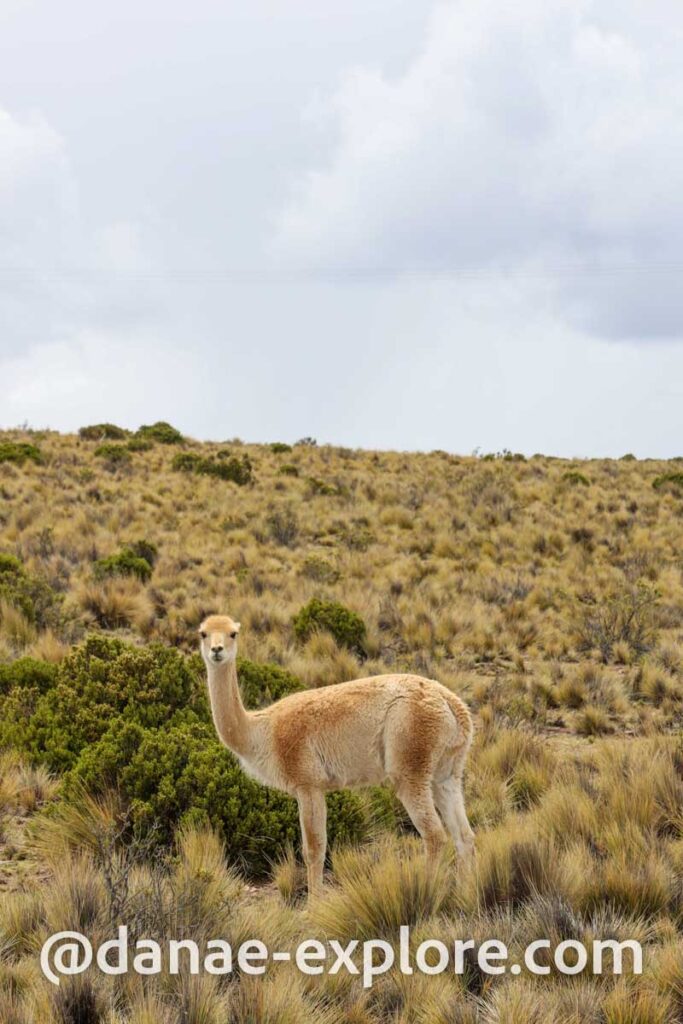
An itinerary that passes through adobe villages seemingly frozen in time, vineyards producing some of Argentina’s finest wines, and countless viewpoints, each more beautiful (and surreal) than the last. Along the way, you’ll spot llamas, guanacos, and plenty of Andean wildlife, and if you’re lucky (or unlucky), you might even see snow in the middle of summer — right in the desert!
Are you in?
First of all, follow me on Instagram @danae_explore – that’s where you can keep up with my trips, find lots of travel tips, and send me a DM anytime. I love chatting about travel!
We experienced all of this on our ten-day adventure through northern Argentina. In this post, I’m sharing our full itinerary with all the details, but if you have any questions, feel free to reach out to me on Instagram — I love talking about travel!
Still relatively undiscovered by tourists, Argentina’s northwest absolutely deserves a spot on your “next destinations” list. And even better if you go soon — before the crowds arrive and that magical sense of discovery starts to fade.
.
Check out all our posts about traveling in Argentina and Chile:
- El Calafate and Perito Moreno Glacier – the best of Argentinan Patagonia
- The best of Ushuaia – A 4-day itinerary for spring and autumn
- Northern Argentina: complete 10-day itinerary through Salta and Jujuy
- Torres del Paine photographic expedition – Chilean Patagonia
Northern Argentina ten-day itinerary – overview
If there’s one thing I love, it’s planning travel itineraries! This one was a joy to put together and turned out exactly as we wanted: a road trip to explore the Andean region of northern Argentina in a limited time frame, while still keeping things relaxed and unhurried.
We live in São Paulo and flew to Salta, with a layover in Buenos Aires, on Aerolíneas Argentinas. That’s why this itinerary starts and ends in Salta, covering the provinces of Salta and Jujuy.
This itinerary is designed for a road trip. If you don’t have your own vehicle, you can easily rent one in Salta. Take advantage and get a quote here (and use my coupon DANAE for a 5% discount).
.
.
At the time we traveled, there was a direct flight, also with Aerolíneas Argentinas, connecting São Paulo and Salta on Saturdays, but we couldn’t take it because our trip didn’t start or end on a Saturday. Since flight schedules change constantly, it’s worth checking, when planning your trip, which is the most practical way to get there — who knows, maybe you’ll be lucky enough to catch that nonstop flight? To see all flights departing from a specific airport, I use FlightsFrom.
.
.
Our itinerary in Northern Argentina
1️⃣ Arrival in Salta, pick up rental car and drive to Tilcara.
2️⃣ Tilcara: explore nearby attractions: Pucará de Tilcara, the High-Altitude Botanical Garden, Devil’s Throat, and Maimará.
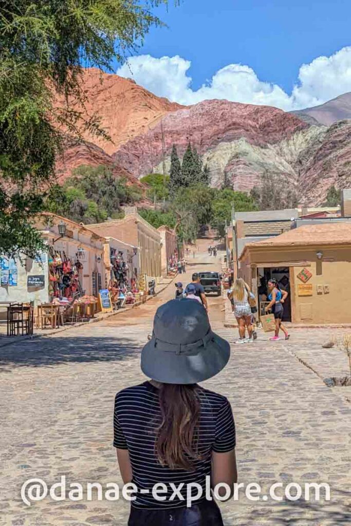
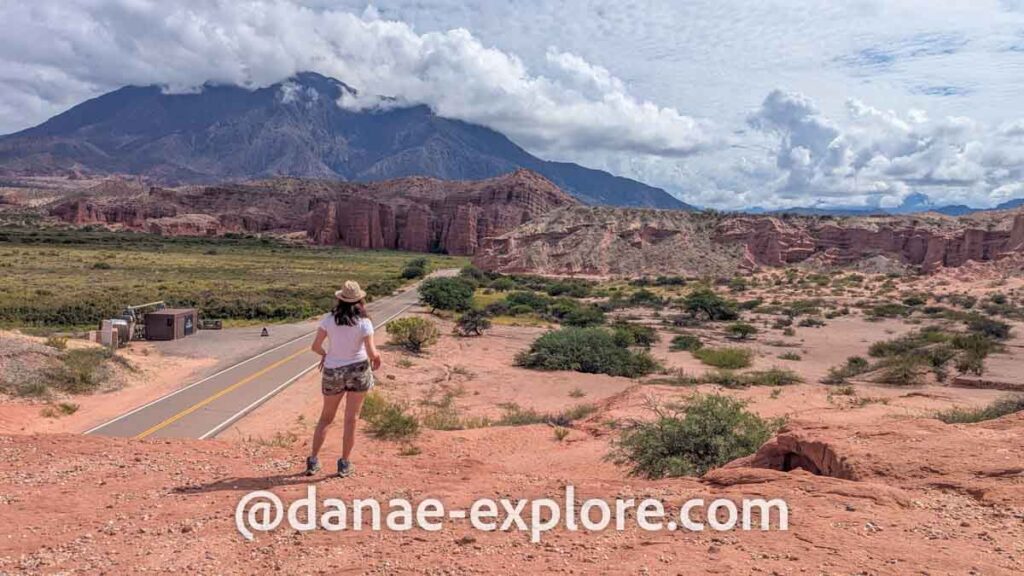
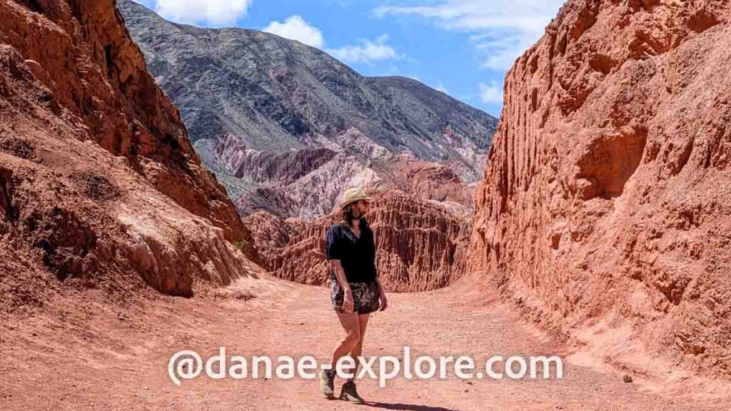
3️⃣ Tilcara: Day trip to Humahuaca, visit Cerro de las 14 Colores (bring warm clothes!) and explore Quebrada de las Señoritas.
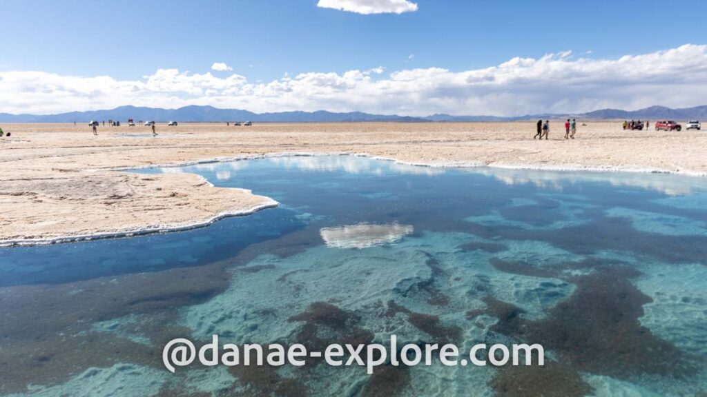
4️⃣ Salinas Grandes, with a stop at Posta de Hornillos. Overnight in Purmamarca.
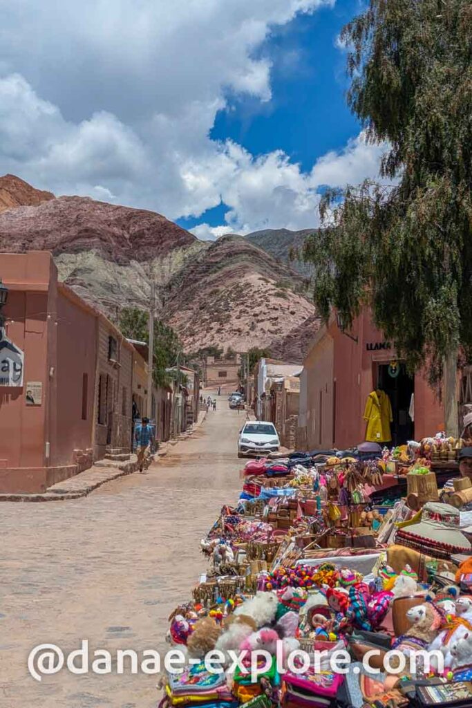
5️⃣ Purmamarca: visit Cerro de los 7 Colores, hike the Los Colorados trail, and enjoy the view from Mirador Porito.
6️⃣ Salta: ride the Cerro San Bernardo Cable Car and visit the Museum of High Mountain Archaeology (a must-see!).
7️⃣ Drive to Cachi, passing through Los Cardones National Park.
8️⃣Drive to Cafayate via Ruta 40 (unpaved road).
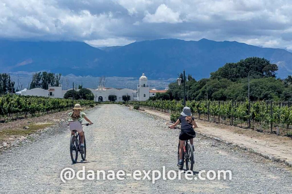
9️⃣ Cafayate: explore the region’s wineries.
🔟 Return to Salta via Route 68. Overnight in Salta and flight back home the following morning.
We took this trip between late December and early January, making the most of the holiday break — something we often do, like when we traveled through Southeast Asia or Eastern Europe.
Altogether, we spent 11 days in the region, since we set New Year’s Eve aside to simply relax. We were in Salta that day, and it turned out to be a slow-paced, quiet celebration — no big plans, just taking it easy. That meant we had two full days in Salta, although the city’s main highlights can easily be seen in one, as outlined in the itinerary above.
.

.
Where to stay in Northern Argentina
.
When planning a trip, there’s nothing better than getting accommodation recommendations from someone who has already tried and tested them, right? So here’s a list of the places we stayed during our trip — along with my honest opinion on each one, as well as some suggestions we gathered along the way.
.
Where to stay in Salta
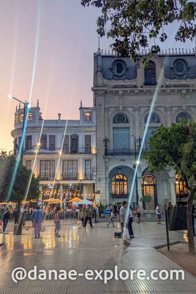
Salta, one of Argentina’s largest cities, offers accommodation options for all types of travelers. I recommend staying in the city center, near Plaza 9 de Julio, where you’ll find historic buildings, charming cafés, great restaurants, and a vibrant cultural scene.
We passed through Salta three times on this trip. On the first two occasions, we stayed at Hotel del Antiguo Convento. Located in a historic building near the Convent of San Bernardo and the Church of San Francisco, the location is great, the service was good, and the rooms were reasonable. The breakfast could have had more options, but it didn’t detract from the experience.
On our third visit to the city, we stayed at GS Hotel, also in the historic center, but in a more modern and less charming building. The rooms were good and the bathroom was fine; we didn’t try the breakfast because our flight was leaving very early in the morning.
Between the two, I preferred Hotel del Antiguo Convento. Both are in the same price range and offer the same level of comfort, but I found the first one more charming and pleasant. Neither has its own parking, but there are several options in the area (including street parking if available).
Hotel Boutique Balcón de Plaza, in a beautifully restored historic house, would have been my choice if it weren’t for the higher price. With a similar name, Solar de La Plaza is also among the best in the city.
For those looking to save money, we received excellent recommendations for Hotel Residencial España. Another affordable alternative is Ferienhaus Hostel Salta, simple, well located, and with good value for money.
.
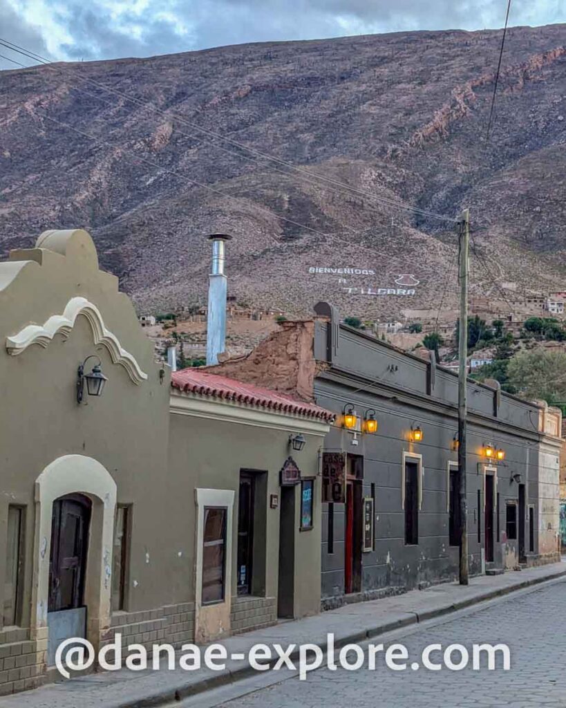
Where to stay in Tilcara
In Tilcara, we chose Hotel Tulmas and it was great. New, well located, with comfortable rooms and attentive service. Part of the group stayed in a double room, and the others stayed in apartments for up to four people, with a living room, bedroom, bathroom, and kitchenette. Breakfast (one of the best of the trip!) was served in the apartment itself.
Other options I had selected for this trip, offering comfort and a reasonable price, were Hostería La Celestina and CasaCalma Boutique Hotel. It is also worth considering Hotel El Reposo Del Diablo, which has a small swimming pool (something rare in the region, given the extremely dry climate).
If you are looking for a more sophisticated hotel, Las Terrazas Hotel Boutique is one of the best in the city.
.
.
Where to stay in Purmamarca
.
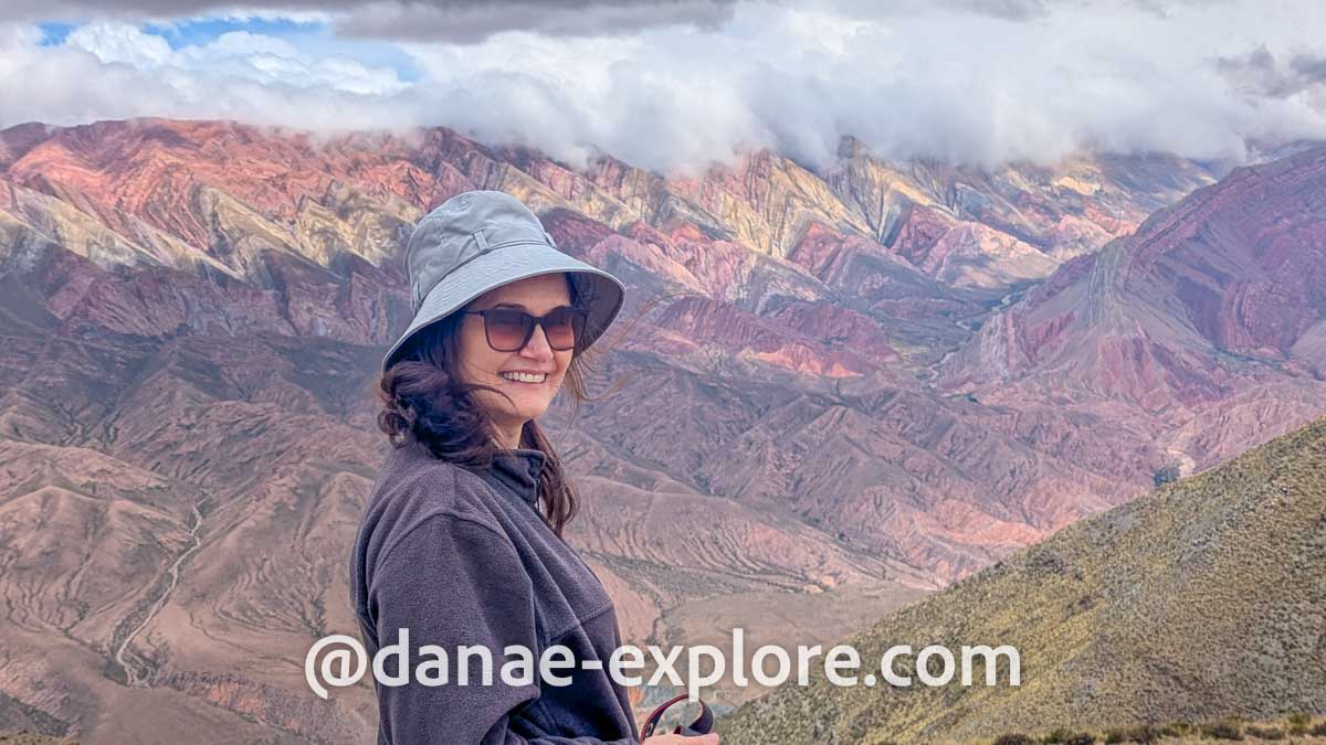
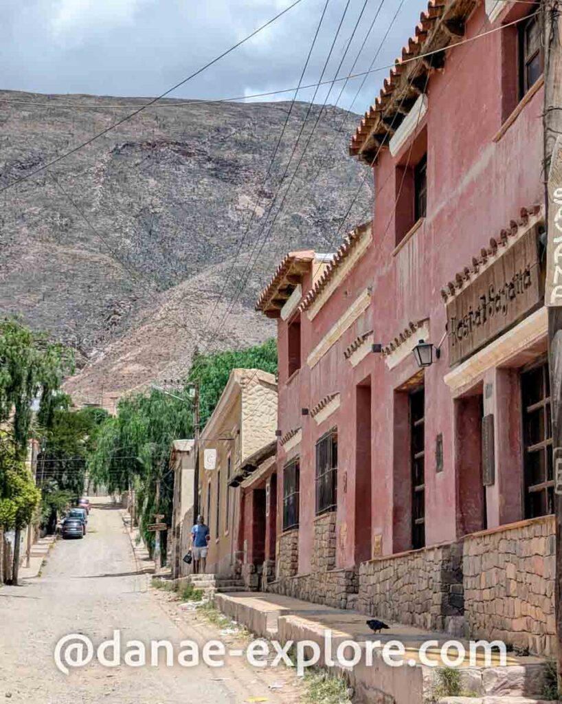
Purmamarca is a charming Andean village surrounded by multicolored mountains . While there are several accommodation options, they generally seemed simpler than those available in Tilcara.
We stayed at Mirador del Virrey Cabañas Boutique, about 2 km from the center. The family apartment was spacious (two bedrooms, a living room, and a kitchen) and well-organized, though quite simple. Breakfast, served in the room, was basic and included instant coffee (unnecessary!). Overall, it was a good option for the price.
In town, I had considered Hosteria La Pushka and Posta de Purmamarca, both well-rated and comfortable.
For something a little more special, Los Colorados Cabañas Boutique and Hotel El Manatial del Silencio stand out as some of the best high-end options in town.
.
.
.
Where to stay in Cachi
.
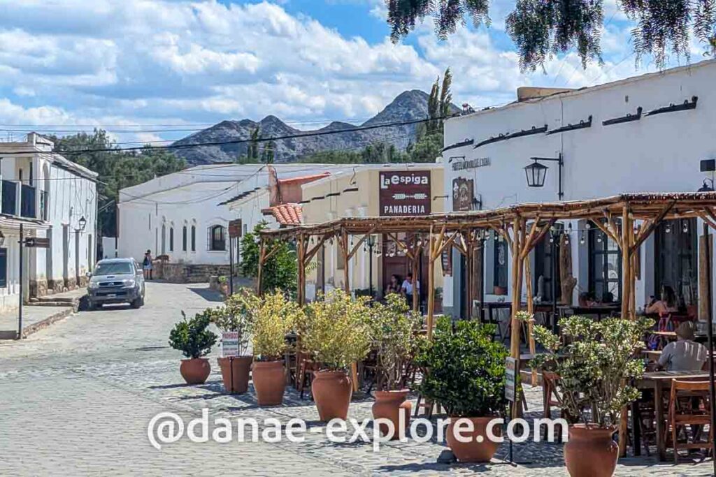
In Cachi, we stayed at Loma Puskana, one of the most enjoyable accommodations of the trip. The inn has a few rooms in the main house (where we stayed) and cottages spread around a lawn and small vineyards. The owners were incredibly welcoming, the breakfast was excellent, and there’s even a stream at the back, where we found a small waterfall and a natural pool — endless fun for the kids!
Other great options include Miraluna Bodega Boutique and La Merced del Alto, both featuring swimming pools. These are all located outside the town center, so having a car is essential.
If you prefer to stay in the village, Hostería Villa Cardon has a great location and a cozy atmosphere — we stopped by the café next door for coffee and loved it. A more budget-friendly choice is Viracocha Art Hostel Cachi, which is well-located. We had dinner there, but the pizza was a bit disappointing (it tasted like a frozen store-bought one).
.
.
Where to stay in Cafayate
.
Cafayate is one of Argentina’s premier wine regions, so it’s no surprise that the town offers a wide range of accommodations, from simple stays to dreamlike retreats.
We wanted something central with good value for money, and Cajón de Água fit the bill perfectly. The friendly staff, excellent breakfast, and small communal kitchen/dining area — great for unwinding with a snack after a long day of exploring — made it a fantastic choice.
Other options I considered were the Hostal Tierra de Vinos, Altos de La Pacha and Hotel Killa Cafayate. For budget travelers, Hostal Cielito Lindo is a well-located and affordable alternative.
If you’re looking for a luxury stay, Patios de Cafayate is an absolute dream — just take a look and tell me it’s not the perfect eno-Andean escape! Another top-tier option is Grace Cafayate, set amidst stunning vineyards, sure to impress even the most discerning traveler.
.
.
What it’s like to drive in Northern Argentina
We rented a car in Salta – I always use RentCars (use this link) and apply the DANAE promo code for a 5% discount – and we traveled almost two thousand kilometers across the northern and northwestern region of Argentina, passing through the provinces of Salta and Jujuy.
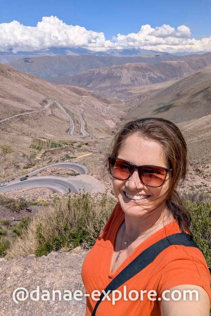
The roads in this region are mostly single-lane, and you should be prepared for a lot of curves. And when I say a lot, I mean a lot. Expect frequent altitude changes, with steep climbs and descents throughout the journey. Driving here is like a continuous rollercoaster of twists and turns.
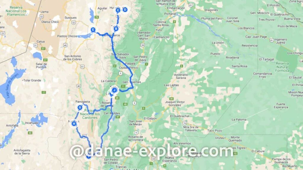
The route we followed is shown on the map below. The central point (marked with the letter J) is Salta, where we both started and ended our trip.
.
Driving from Salta to Jujuy (Tilcara, Purmamarca, and Humahuaca)
The first stretch of our trip took us north from Salta to the province of Jujuy.
To get from Salta to San Salvador de Jujuy (the capital of Jujuy), I highly recommend taking the route shown on the map, leaving Salta via Ruta 9 eastbound, passing through Cobos and General Güemes, and continuing on Ruta 34.
We made the mistake of trying to take a shortcut by staying on Ruta 9 northbound, passing through La Caldera and El Carmen — and let me tell you, don’t make the same mistake.
The road through this section is absolutely stunning, with a breathtaking stretch that cuts through dense forest. But it’s also extremely narrow and ridiculously winding. Picture a road made up entirely of sharp curves—that’s what you’ll get. The speed limit rarely exceeds 30 km/h (18 mph), there are no passing lanes, no shoulders, and virtually no room for error. It’s not for the faint of heart! Check out my Instagram highlights for a video of this stretch—you’ll see exactly what I mean.
On our way back from Jujuy to Salta, we followed the recommended route on the map, and it was a much smoother and easier drive.
From San Salvador de Jujuy to the towns we visited—Purmamarca, Tilcara, and Humahuaca — the road conditions were quite decent (it’s the same Ruta 9). It’s still a single-lane highway, but it’s well-marked, with shoulders, rest areas, and proper signage. One thing to note: gas stations are few and far between, so plan ahead and don’t let your tank get too low!
.
To rent a car, I always use RentCars, where I usually find the best options, and with the DANAE promo code you still get an additional 5% off. Shall we go?
.
Driving from Humahuaca to Hornocal
To reach Hornocal (also known as Cerro de los 14 Colores or Serranías del Hornocal) from Humahuaca, you’ll drive 24 km (15 miles) on an unpaved road, with a series of curves near the final stretch.
When you arrive in Humahuaca, you might feel some pressure to book a guided tour with a 4WD vehicle — locals tend to warn visitors against driving up in their own rental cars, often exaggerating the risks. We didn’t fall for it, though — we went ahead with our own little rental car, and everything turned out just fine!
Hornocal sits at 4,350 meters (14,270 feet) above sea level, while Humahuaca is at 3,000 meters (9,840 feet). It’s a steep climb with plenty of curves, but we had no issues. That said, if it has recently rained, proceed with caution, as the road conditions can deteriorate.
.
.
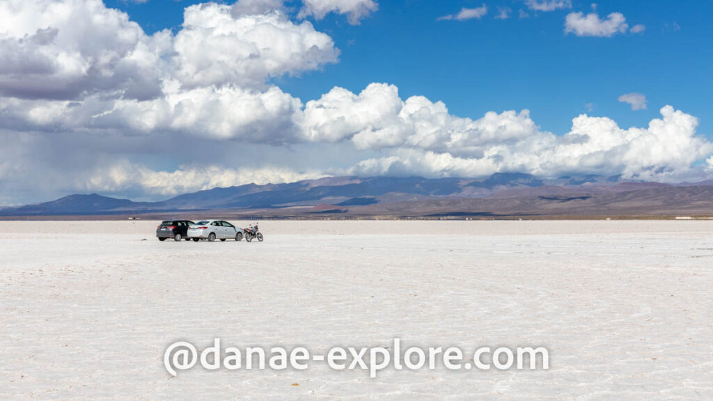
Driving from Purmamarca to Salinas Grandes
The drive from Purmamarca to Salinas Grandes follows Ruta 52, a fully paved road in excellent condition.
Yes, there are curves, especially in the region of Cuesta de Lipán, where we climbed to a pass at 4,170 meters of altitude (of course we stopped for the classic photo). Even though it has many curves, it’s not scary. Go with your rented economy car and you’ll be fine, no need to worry.
Once you arrive at Salinas Grandes, you’ll explore the salt flats in your own car, but only under the guidance of a local tour leader. The guides ride ahead on motorbikes, and it’s essential to follow their exact route — beneath the salt crust, there’s hidden water, and straying off course could easily leave your car stuck.
.

.
Driving from Salta to Cachi
The second part of our trip took us south of Salta, where we visited Cachi and Cafayate.
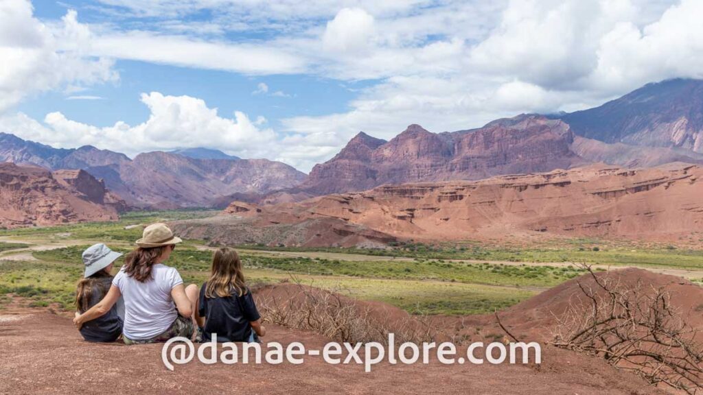
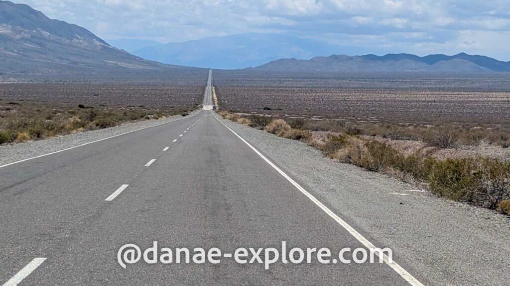
From Salta, we took Ruta 68 to El Carril, then turned onto Ruta 33, passing through Quebrada de Escoipe and Los Cardones National Park before reaching Cachi.
A short section of the route is unpaved, but the road is generally in good condition. Expect plenty of curves, along with steep inclines and descents. One of the highlights of Los Cardones National Park is the Recta de Tin Tin, an 18-km (11-mile) perfectly straight stretch of road (and yes, it’s paved!), which was once part of an ancient network of trails built by the Incas.
.
.
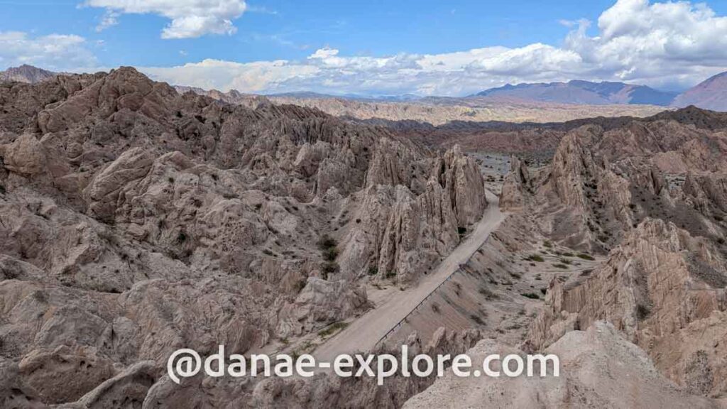
Driving from Cachi to Cafayate via Ruta 40
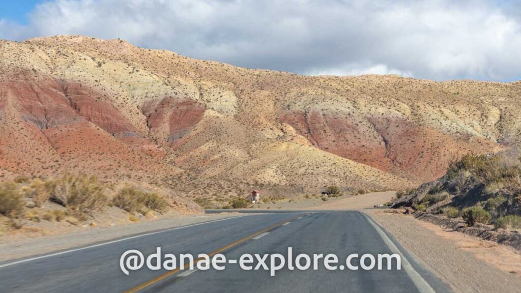
From Cachi, we continued to Cafayate via Ruta 40, one of the most famous scenic roads in Argentina. With 5,224 km long, Ruta 40 is the longest road in the country. It runs from the border with Bolivia in the far north to the south of Patagonia, running parallel to the Andes mountain range.
We drove the 156 km stretch between Cachi and Cafayate. The route is almost entirely gravel, except for a few paved kilometers as you approach Cafayate.
It was, by far, the worst road we took on the trip.
The road starts bad, then gets worse, and just when you think the worst must be over, it gets even worse.
We shook non-stop during the five hours the trip lasted. We stopped in Molinos for lunch at El Rincón de las Empanadas, which served some of the best empanadas we had on the trip (and there was no shortage of empanadas on this trip).
The route is beautiful, with some truly impressive stretches — the Quebrada de las Flechas is spectacular — but after a while, the mountains with their thousands of colors begin to look the same, and all you want is to find asphalt as quickly as possible.
We went with a rental car, and everything went smoothly; we didn’t have any issues along the way. If it had rained, I’m not sure we would have been as lucky. Was it worth it? YES. Would I do it again? That same stretch, NO. But a route with this level of adventure somewhere else in the world? YES, without a doubt.
To rent a car, I always use RentCars, where I usually find the best options, and with the DANAE promo code you still get an additional 5% off. Shall we go?
.
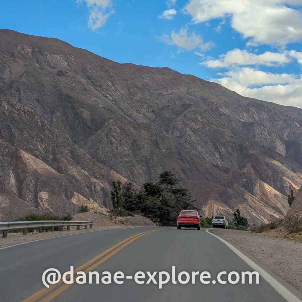
Driving from Cafayate to Salta via Ruta 68
From Cafayate to Salta, we took Ruta 68, another scenic road in Argentina and, in this stretch, fully paved.
The most beautiful part is right after leaving Cafayate, in the region of Quebrada de las Conchas and Quebrada de Cafayate. Rock formations sculpted by water and wind over thousands of years change the landscape at every curve, with each viewpoint more impressive than the last. It is worth stopping at all the viewpoints and formations; some of the most interesting are El Sapo, El Anfiteatro, Tres Cruces, Los Colorados, and La Yesera.
.
.
Adjusting your Northern Argentina itinerary
Using our itinerary as a base, you can tailor your trip to match your interests. Here are some suggestions:
The itinerary is divided into three sections: Salta, the northern region (Tilcara & Purmamarca), and the southern region (Cachi & Cafayate). The good news? The order doesn’t affect the experience, so feel free to rearrange the sections in whatever way best suits your trip.
Over these ten days, we passed through Salta three times: upon arrival, midway through the trip, and at the end. That final stop was necessary for our return flight home, but an alternative would have been flying out of Tucumán, which is slightly farther from Cafayate than Salta.
Are you a wine enthusiast? Because you won’t be disappointed with Cafayate. Situated more than 1,700 meters above sea level, it’s one of the highest wine regions in the world. The region’s flagship grape is Torrontés, but I also tasted a Malbec that was delicious. There are dozens of wineries in the area, enough to keep you entertained for a few days.
Can you drive to Northern Argentina? Absolutely! Not only is it possible, but it’s actually quite common to drive there — whether from Patagonia, Buenos Aires, Uruguay, or from my home country. Along the way, we met several Brazilian travelers who had driven to Salta from the southern and southeastern states back home. If you love a good road trip, this is a great option. From what we gathered, most people take about three days to drive from São Paulo to Salta — one day in Brazil and two in Argentina — though some told us they managed to do it in just two.
Thinking about combining Northern Argentina with Atacama and Salar de Uyuni? Many travelers include Northern Argentina as part of a larger itinerary covering San Pedro de Atacama in Chile and Bolivia’s Salar de Uyuni. Since we had already visited both on a previous trip and had limited time, we decided to focus solely on Argentina this time. If you’re renting a car, be sure to check with the rental company about crossing international borders.
.
.
Map of our Northern Argentina road trip
Our 10-day, 1,850-kilometer road trip through Northern Argentina is mapped out below. Just click to save it to your Google account! When it’s time to plan your own adventure through the Argentinean Andes, you’ll know exactly where to start.
How to use this map: Click the menu tab in the upper left corner of the map to access different layers, including points of interest and routes. You can toggle layers on and off by checking the corresponding boxes. To see details about specific locations, click on the icons on the map.
To save this map to your Google Maps account, just click the star icon next to the map title. To access it later on your phone or computer, open Google Maps, tap the menu button, go to “Your Places”, select “Maps”, and you’ll find this map saved there.
.
Here are the websites I always use to plan my trips:
– 🛌 Accommodation: Booking
– ☀️ Tours & activities: Civitatis & Get Your Guide
– 📱 eSIM for mobile data: Airalo e-SIM – use promo code DANAE2375
– 🚗 Car rental: RentCars – use promo code DANAE
Check out all our posts about traveling in Argentina and Chile:
- El Calafate and Perito Moreno Glacier – the best of Argentinan Patagonia
- The best of Ushuaia – A 4-day itinerary for spring and autumn
- Northern Argentina: complete 10-day itinerary through Salta and Jujuy
- Torres del Paine photographic expedition – Chilean Patagonia
Here are our posts about other destinations in South and Central America:
Guatemala
Colombia
- The best of Colombia – 12-day itinerary
- What to do in 3 days in Bogotá
- What to do in Cartagena de Indias – Colombia
- How to visit Tayrona National Park – the most beautiful beaches in mainland Colombia
Chile
Belize
- One week in Belize: a perfect itinerary for first-time visitors
- What to do in Belize: the best of San Ignacio, Caye Ambergris and Caye Caulker
All our posts about traveling in Brazil, be sure to check them out before planing a trip to my home country:
- Brazilian Amazon – How to visit the Amazon Rainforest
- What to do in Alter do Chão: Exploring amazonian beaches and rainforests in Brazil
- What to do in Chapada dos Guimaraes, Mato Grosso
- The best tours to do in Bonito, Brazil, in 4 days
- Ultimate Guide to Bonito: Exploring the Southern Brazilian Pantanal’s Hidden Paradise
- Complete guide to visiting Lençóis Maranhenses: Tips and essential itinerary
- Chapada das Mesas – Complete itinerary: what to do, where to stay, how to get there
- What to do in Pirenópolis: ecotourism and history in the interior of Goiás
- Chapada dos Veadeiros – Complete guide: best waterfalls, accommodations and many tips.
Here are the websites I always use to plan my trips:
– 🛌 Accommodation: Booking
– ☀️ Tours & activities: Civitatis & Get Your Guide
– 📱 eSIM for mobile data: Airalo e-SIM – use promo code DANAE2375
– 🚗 Car rental: RentCars – use promo code DANAE
Did you like these tips? Then follow me on social media:
Instagram @danae_explore
Pinterest @danaeexplore
Comments or questions? Contact me on social media.! I love to chat about travel 😉
And before you go, don’t forget to SAVE THIS PIN to your PINTEREST account for easy access to this post on our road trip itinerary through Northern Argentina whenever you need it!